There will be no further updates to this site. Please see http://steven.vorefamily.net/2020/02/14/michael-vore/
Gone Home
Reply

There will be no further updates to this site. Please see http://steven.vorefamily.net/2020/02/14/michael-vore/
I’m always on the lookout for more Small Towns. This is possibly not qualified as a Town, Hamlet, or even a Village. It’s just a place. But I’ll call it a town for now.
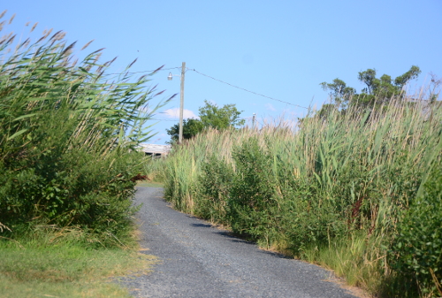
One of my stops on a vacation trip to Colorado was a small town of Mingo Kansas. From I-70 one goes west on County-K for about a mile, don’t blink or you might pass right through. Mingo’s main claims to fame is that it is the home of the oldest Geocache appropriately named Mingo. Placed in May of 2000, this cache is on the bucket list of many geocachers, we like finding geocaches of special significance. After finding the geocache I proceeded into Mingo itself to do a bit of exploring. The following photos don’t show much, and that’s right. There’s not much to the town, maybe a dozen houses, a church, the requisite Grain Elevators and a railroad. Most of the roads in the area are dirt, well, the Interstate is paved. From 1888 until 1940 Mingo had a post office. The closest towns of any size that show up on Google Maps are Colby and Oakley, each about 10 miles away.

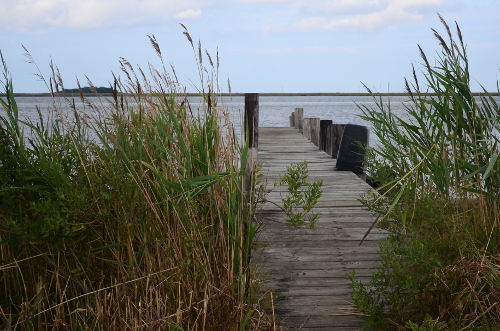
Looking to the north the tracks seem to go on forever.
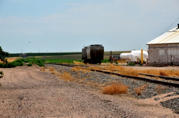
Looking the south the tracks go on forever too, but with a siding.

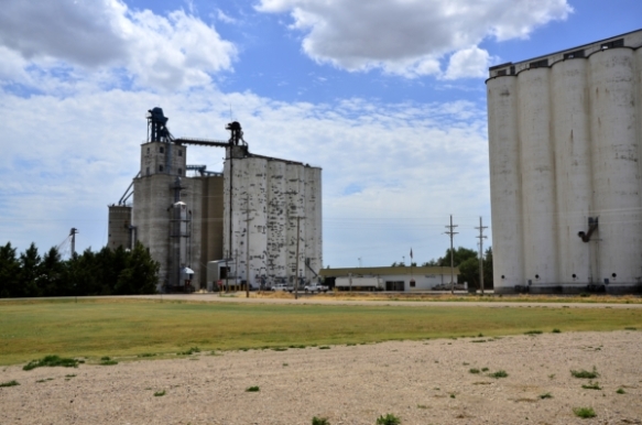
Out in Wheat country, whatelse but grain elevators, of course they are along the railroad tracks.


While I was wandreing around in Mingo, these three horses were the only living cratures i saw.

What’s being hidden by the bush. There’s got to be something lurking in the window.
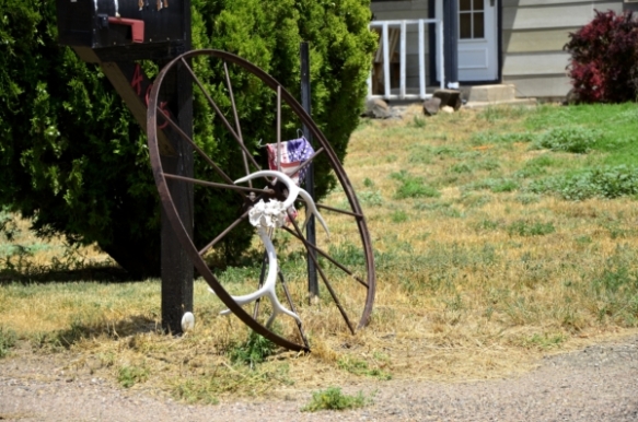
This sees to be local art.

None of the grass seemed long enough to need mowing. and the day I was there I doubt that the grass would grow. the temperature was near 100F and sunny.
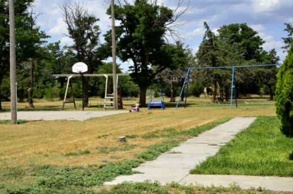
Where are the kids for the playground. Probably it is used when the parents are spending Sunday mornings in the Church.
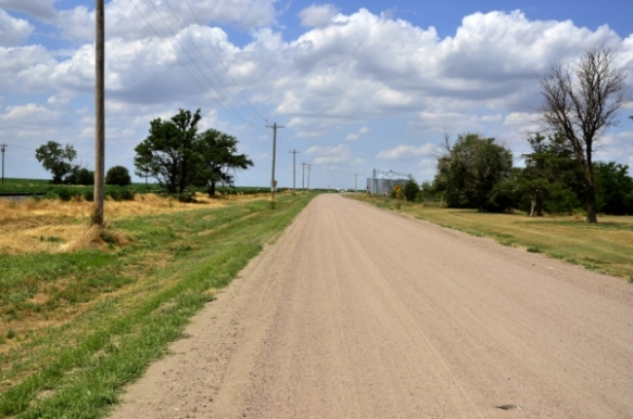
This looks like a typical rural road in Kansas – dirt.
Got any ideas of towns you’d like to see? Send me them in the comments.
Tylerton, Smith Island, MD
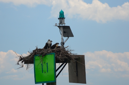
Three Juvenile Osprey on channel marker 11

TylertonThe “Port of Entry” is at the dock by the crain.
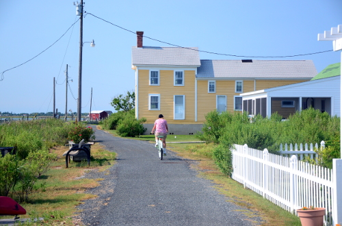
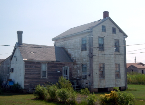
We’ve left Virginia behind and headed to the Eastern Shore of Maryland. This stop is on Tylerton one of three villages on Smith Island, Md, a small cluster of islands on the Maryland Virginia border. Smith Island lies about 9 miles east of Crisfield, the currently the only place to catch a boat that will take one to Smith Island. The other half of the cluster of islands is Tangier Island, Va. about 10 miles south. Listening to native familys takes one back in time, the dialect comes from Cornwall, the language is English but at times can be hard to understand. “Smith Island” consists of many pieces of land, the largest town is Ewell, then the town of Rhodes Point, and the smallest is Tylerton. Each on its own island.

The “Welcome Center”. It’s the first stop after after fetching baggage from the “Caption Jason II”, the only way on and off the island.
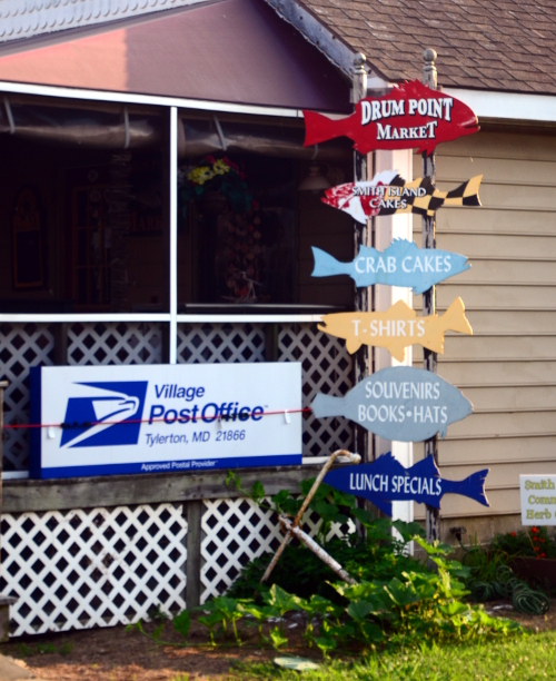
Tylerton does have its own Market and Post Office.
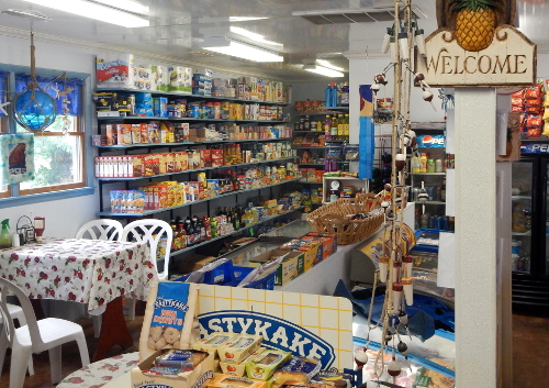
The Drum Point Market supplies the necessities of life as well as delicious sandwiches for made to order.
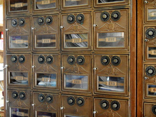
Yes, those antique PO Boxes are still used.
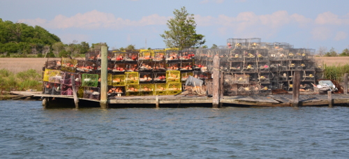
The main “industry” of the island is crabbing, though crabs are not as plentiful as they once were. Almost everywhere one looks you can see “crabpots“. Crabpots are one of the methods used to catch crabs.

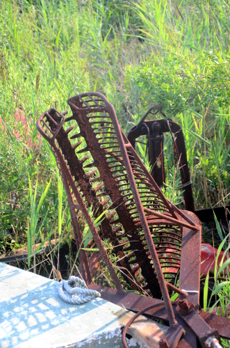 Oyster tongs, used to pull Oysters from the bottom during the open season.
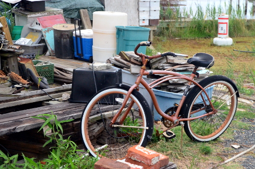
With a population of about 50 the longest street, Tylerton Rd is less than 1/2 miles long. Two Firetrucks, One Ambulance, and one Pick-Up truck make up the fleet of vehicles. However, Golf Carts abound, as well a bicycles. Most of the bikes I saw were “Beach Bikes” , one speed with coaster brakes. Long distance biking just isn’t done in Tylerton. The few I saw up close were wearing a Huffy Logo.

Outside the Drum Point Market at lunch time, plenty of parking space

Crowded parking at the dock just before the morning run to Crisfield.

Not a Yellow Cab, or even an UBER Car.
Before I take a photo stroll I want to mention, there are places to stay, one is “The Inn Of Silent Music“. The inn, a B&B serves wonderful breakfasts and dinners. Lunch are available at the Drum Point Market. If you time your visit right the Inn might serve a Smith Island Layer Cake. On the night I was lucky enough to have a piece, one of the layers included Peaches.


Sunset from the Inn Of Silent Music


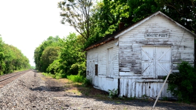
Again, I’m back in Virginia on a scenic byway. Cruising down US 340 south of US 50, I came to Va 659, a small road off to the left. Not wanting to stay on major highways, I took the turn, and in about half a mile, I came to the small town of White Post.
 True to its name, there was a white post sitting in the middle of the only intersection in town. Atop the post are street signs for the four roads leading out from it.
Turning left at the post on “Berry’s Ferry” took me out of town. Soon, I was out in the countryside passing by farms, when I came upon the White Post Railroad Station, now standing abandoned and unused.


Returning to the white post for a short photo walk led me to some really old historic buildings and two churches standing side by side.

1797 Livery Stable General Store
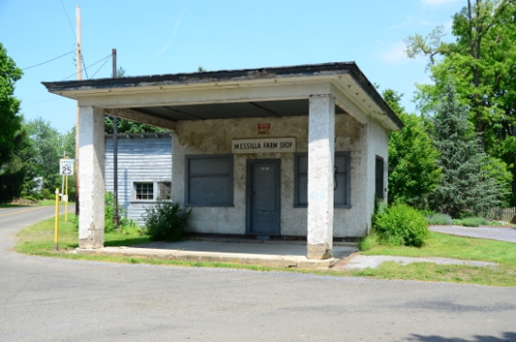
Messilla Farm Shop

Greenway Court Parish
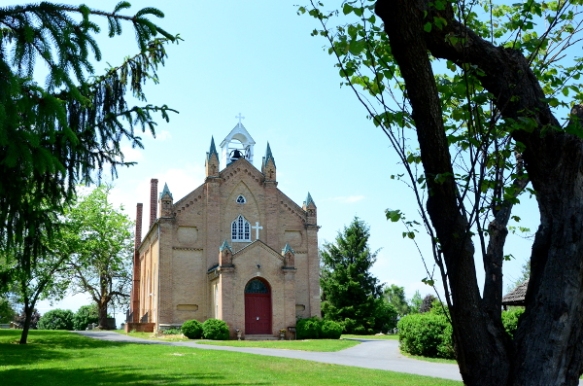
White Post United Methodist


Post Office
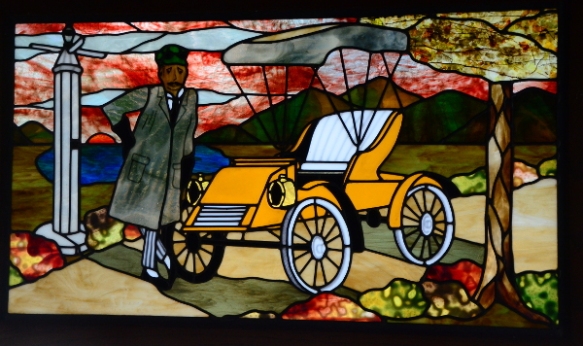
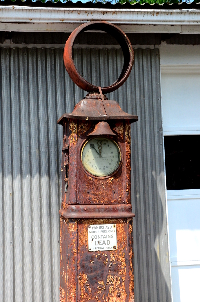
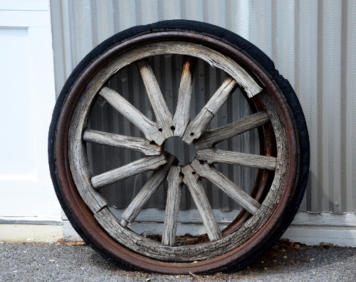
Walking south from the Post Office one comes to the only business in town. White Post Restorations. If you’re even close to White Post, be sure to stop in, it’s definitely worth your time.
By “restorations” they mean antique car restoration. Cars and all kinds of other vehicles are being restored to look like new, or even better than new. It’s not a showroom or museum, it’s a working restoration shop. Stop in the office and introduce yourself, and ask about taking a look around


So far my wanderings have been on the Western shore of Maryland, and into Georgia, Virginia and Pennsylvania. For this month’s article I’ve ventured into the Eastern Shore of Maryland, Chestertown, the county seat of Kent County. The latest census counted a bit over 5000 residents. Chestertown sits on the Chester River and is home to Washington College. Chestertown has a rich maritime history. What follows is a small collection of photos that show the some of the town when it is not having one of many festivals.


In the fall Chestertown is home to the Sultana Project’s Downrigging Weekend, one of the largest annual Tall Ship and wooden boat festivals on the East Coast. The Pride of Baltimore II‘s home is just across the bay, in Baltimore’s Inner Harbor also makes it’s annual appearance, taking time off from visiting other ports of call. The Downrigging has become a celebration of maritime culture, wooden boats, and everything else that makes the Chesapeake Bay great.


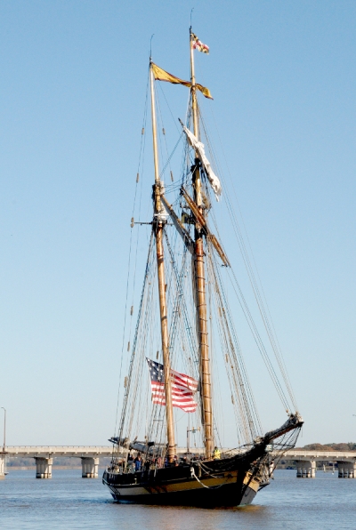
The Priode of Baltimore II in the Chester River
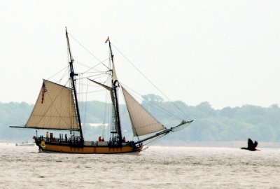
The Sultana under sail in the Chesapeake Bay
I’m not sure where my travels will bring me next, but I’m planning on somewhere more inland. Anyone with suggestions is encouraged to send them along as a comment.
I guess I could sign off with TTFN (who knows what that means?)

